Whether you are a fan of technology or prefer the old-school pen-to-paper methods, there are several tools to measure distances. However, one question remains: which is the best? Although best is a relative term, depending on your situation, the best tool is arguably digital mapping software like Google Maps, although string or thread is a comparable option for those who don’t have technology at their disposal.
GPS Devices
A GPS is an electronic device that uses signals from satellites to determine its location on Earth. To measure the distance between two addresses, you set waypoints or specific coordinates for those locations using the GPS device. You can then select these waypoints on the device’s map interface or enter them as latitude and longitude coordinates. With the two addresses input, the GPS device will calculate the distance for you.
The GPS might be slightly less common on the list of tools, with its main drawback being its battery life since these devices require power, and carrying spare batteries isn’t always an option. At the same time, GPS devices rely on signal reception, meaning a signal can be weak or lost when it comes time to begin your navigation.
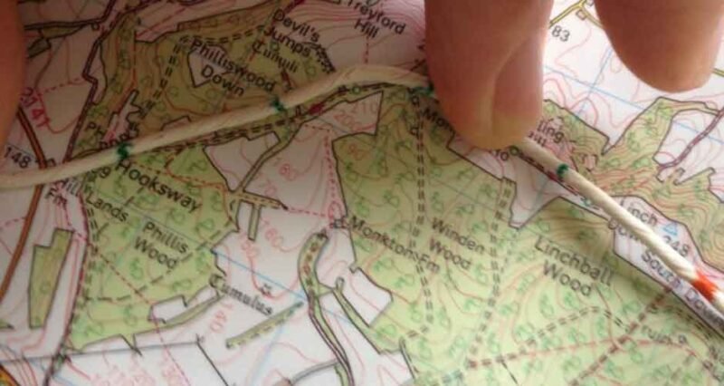
String or Thread
Using a string or thread, you can trace the path you want to measure on the map, then measure the length of the string against a ruler or a known scale to determine the distance. On the one hand, string or thread is simple to use since it requires no special tools or technology while also being cost-effective. Unfortunately, this method isn’t without cons. Using string also comes with less precision since accuracy becomes a matter of the thickness of your tools. It may also be time-consuming if the distance is long and the scale is small.
Digital Mapping Software
A third tool you might want to consider is digital mapping software like Google Maps or Maptive. To use these tools, you can start by opening their interface in a web browser and making the selection to “Measure distance.” After doing so, you will have the option to select a second location on the map, after which digital mapping software tools will display the distance in a window at the bottom of the page. If you need to measure a more intricate path, simply continue by clicking on additional points. After adding each new point, you’ll see the distance at the bottom of the page as it updates accordingly.
As a digital tool, mapping software allows users to calculate distances with complex routes and share them with others. The cons include the software’s cost and the learning curve that may come with the tool.
A Wide Array of Choices
Whether you opt for traditional manual methods, digital mapping software, or GPS technology, the best tool for measuring distance on a map is the one that aligns with your specific requirements and suits your level of comfort with technology. As mapping and navigation tools continue to advance, users have various choices to make distance measurement accurate and accessible in various scenarios.